Tag Archives: Hiking & Climbing Adventures
Utah’s Slot Canyons »
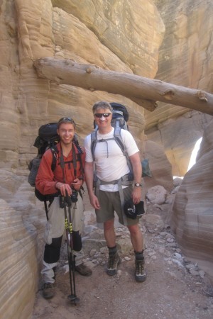
Posted on October 19, 2013Deep in Southern Utah’s remote desert landscape sits the Grand Staircase-Escalante National Monument. Protecting 1.8 million acres, it’s an ideal location for hiking, horseback riding, and mountain biking. A place where one can easily find solitude as well as easily get lost in the deep slot canyon creek beds.
For our first adventure into this massive wilderness, we selected the Bull Valley Gorge loop based on the Las Vegas REI team member’s suggestion and the two days we had for accomplishing the weekend trip. Seeing a photo of the deep canyon on the cover of a Utah climbing book further increased our excitement for exploring our first slot canyon.
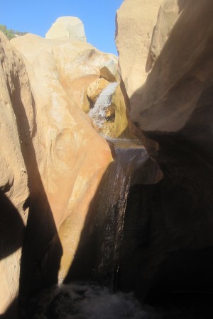
You sit up on a rugged, scraggly plateau as you drive south into the Grand Staircase. What you don’t realize, however, are the deep creek beds that weave throughout the landscape. When starting out with Alex and my brother John, we only had to hike a 1/8 mile down a trail to gain access to the stream bed. It wasn’t too long after that when the gorge got deeper and narrower. The site of the water worn sand walls going straight up for 50-75 feet inspires awe as well as a bit of fear. Some of the passageways were only 3-4 feet wide and the thought of a flash flood is always present. (Check the weather forecast ahead of time!) While not too terribly technical, you do need some rope and the ability to use them for lowering gear and bodies down some of the 15-20 foot drops. Fortunately, for us, Alex has developed a passion for the latest robe techniques!
As you’ll see in the video, we had a lot of laughs and a few falls weaving our way through the long, dark passageways. At 17 miles, the two day loop was a fairly strenuous trek. The second half day was particularly tiring as the creek bed opened up and exposed us to the afternoon desert heat and sun. To say, “bring plenty of water” would be an understatement as we found our jugs bone dry by the time we returned to the vehicle. Oh yes, you’ll need to bring a map with you as navigating in desert landscape and deep canyons can be very tricky. N, S, E or W has a whole new meaning when you are 100 feet down. For a unique and memorable adventure, you won’t be disappointed!
Bring the Map! »
Posted on October 19, 2013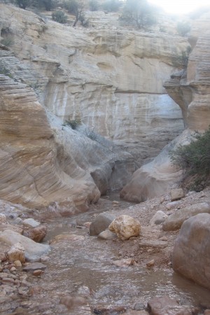 Six miles down a slot canyon with no possibility of going back up, we came to a creek bed junction. We knew we were making a loop back to our starting point 11 miles further on but had different concepts of which direction we should go. My intuition and brief memory of looking at the map in our hiking book said we should go clockwise and thus turn right. Alex’s memory on the other hand said to go counter-clockwise and thus take the canyon to the left. With no trail markers or foot prints to guide us, this would be the time to take out the map and find the correct trail. One problem, however, the book and map were back in the car!
Needless to say, it was some tense moments as we tried to figure out the correct course. I’ve always counted on Alex’s sense of direction but was pretty sure we needed to head down stream at this point. Alex, on the other hand, grew frustrated by my questioning his judgment. (This is a classic dynamic for fathers with young adult children. After years of your being in charge of everything, you want them to take more control. They on the other hand want to feel in control and also be respected by you. It’s an evolving relationship dance that can easily lead to toes being stepped on.) To make matters worse, we both knew that we wouldn’t know who was right for at least another 11 miles up the trail. Running low on water in the desert heat and sun made it all that much more stressful. If we did pick the wrong trail, we would have to retrace our steps the next day and then do another 11 miles to get out. And all without much water!
Needless to say, it was an anxious night’s sleep camping along the dry stream bed 5 miles up from where we hit the junction and wandering if we had made the right choice. We were all pretty exhausted from the day’s pack in and nervous about our dwindling supply of water. Starting out the next morning, it wasn’t until about 3 miles further up the trail that we saw our first signs of other beings in the area. While they appeared to be days old, seeing horse tracks and manure was encouraging. When hooking into another creek bed, we then found running water, deeper slot canyons and some spectacular water falls. Alex was right, we were on the right track. While we were able to laugh about it later, next time, we will all need to be sure that we have a map!
Great Hikes in Southern Utah »
Posted on October 19, 2013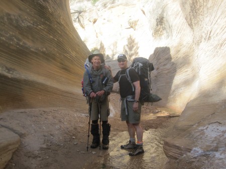 If you are thinking about slot canyons and hiking in Southern Utah, check out Favorite Hikes In & Around Zion National Park by Tanya Milligan and Bo Beck. It’s loaded with great photos and easy to understand directions and maps. They also cover hikes for every age and ability level. Perfect for planning your next adventure no matter what age kids you have. We picked up our copy at REI.
Training at Great Sand Dunes NP »
Posted on October 19, 2013
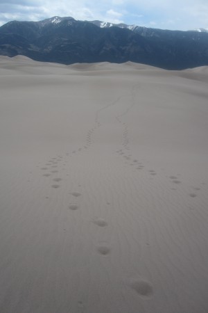
While Colorado is most often associated with her beautiful mountains, there is a small section in southern Colorado that has enormous sand dunes. Formed millions of years ago, Great Sand Dunes National Park sits at the base of the Sangre de Cristo mountain range where blowing sand against the mountain has created the largest sand dunes in North America. The tallest, Star Dune rises 750 feet from the creek bed. Looking from the distance, Great Sand Dunes offers an amazing juxtaposition of sand dunes landscape next to the majestic Rocky Mountains.
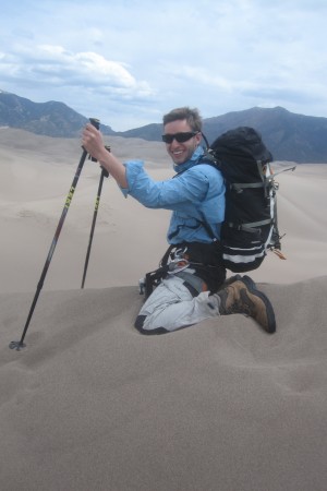
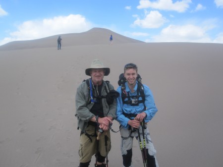
While Alex and I had an adventure here some 10 years earlier when we took a first place ribbon at the annual sand building competition, our purpose for this adventure was much different. We were here to get in some vertical climbing in preparation for our June trip to Mt. Rainier. As such, we decide to go with full packs on. Our course was to climb the High Dune on the east side and then walk right through the middle of the dunes over to Star Dune. We could then easily descend down to the valley floor and follow the creek bed back to our starting point.
If you’ve ever walked through dry sand, you know how much it gives way underneath you. What makes this hike so challenging is that you are sinking in while doing some major vertical climbing. Many a time it felt like one step up and two steps back. To make matters more difficult, the wind howls constantly and the higher you get the more ferocious the sand storms become. After reaching the top of High Dune, and enjoying watching the many sand boarders who ride down the dune), we headed out across the middle. After descending the back side of High, we were treated to an awe inspiring scene of nothing but sand. Every direction we looked, nothing but sand and the blue sky above. To feel like you could get lost in here is an understatement. While hundreds of tourists were at play just a quarter-mile away, it felt like Alex and I were the only two people on earth.
The climb across the dunes was extremely enjoyable. The climb up Star Dune however was a huge challenge. Between the loose footing, the steep slope, and brutal wind gusts, I was down to counting 20 steps before needing to take a rest break. When getting to the top, you quickly get to the back side of the ridge to avoid being sand blasted by the wind. Inspired at the top, we decided to go back the same way rather than going to the creek bed. While a much more difficult traverse, we couldn’t resist the temptation to play in the sand again. For me, having trained in the pool for the past three months, I finally felt I had reached a level of fitness that made it fun to pack and I was encouraged about our upcoming climb up Mt. Rainier. This memorable hike stayed with us for days as we continued to wash sand out of our hair and ears!
A Trip Up Rainier »
Posted on June 26, 2012At 14,411′, Mt. Rainer is one of the five tallest peaks in the lower 48 states. Even more stunning is its location in an amazing national park with easy access. Our adventure to Mt. Rainier National Park was a last minute decision made partly because of an easy flight from Denver to Seattle. Upon arriving in Seattle we rented an SUV and loaded up on supplies at the original REI store in downtown Seattle before embarking on the two hour drive to Mt. Rainer NP’s southwest entrance.
You know you are in climbing country when you arrive in the small town of Ashford just outside the park. There you will find several climbing outfitters, the biggest being RMI, mountaineering shops, and fellow climbers loaded down with heavy backpacks. To contact RMI visit their website www.rmiguides.com. To summit Rainer you have two options. Either book a guided trip way in advance with an outfitter or climb by yourself. Should you choose the unguided option, proper glacier experience and training is necessary. Training courses are available from the outfitters as well. You may also obtain all permits ahead of time (they are only needed to ascend above the Camp Muir base camp located at 10,000 ft.) or pick them up at the ranger station within the park (reservations are recommended).
In our case, glacier training was a problem. We haven’t been trained to climb alone, but had no reserved spots on a guided trip. We put our names on cancellation list with RMI in hopes that other climbers might not show, giving us a chance at the summit. After camping and hiking in the park for a few days we decided to get permits for the Camp Muir shelter and make the trip on our own since nothing opened up at RMI. It’s an easy drive through the park to the Paradise Visitor Center at 4836′. There is a parking lot for climbers and the ranger station has all the maps you might need for shorter hikes or the hike to Muir. Learn more about MRNP by visiting their website, www.nps.gov/mora.
The hike itself is almost entirely on glaciers and snow so boots with crampons are a great idea. While the hike to Muir is only 4.65 miles, it’s uphill and strenuous. The views are spectacular and you feel like you are on Everest as you watch the hiker’s up above you. There is a staircase of steps in the snow for the steepest parts of the trail, created by the many rope teams of mountaineers walking single file. While Alex made it to camp in five hours, it took me an additional two; most of which was spent taking 50 steps and then stopping for a 50 count breather.
As you’ll see in the video, Camp Muir will give you a taste of what it’s like to climb Denali or Everest. The camp has an air of success and ambition as well as apprehension. Bottom line as adventures go, it’s just plain cool!
Dogs and Young Families at 14,000 ft! »
Posted on October 30, 2011This July, Alex, Utah and I set out to climb Mt. Shavano located in south central Colorado in the Collegiate Range. When pulling into the campsite late Friday night, we were surprised to see how many hikers were there for this long and steep peak.
Along the way, we ran into lots of young adult hikers, as well as, numerous families with young children. As you can see on their post (http://adventuredad.org/667/adventures/a-sons-first-attempt/ ), Bryson was one of the youngest kids hiking the trail at 8 years of age as he and his dad ventured from the flatlands of Kansas. When reaching the summit, we were amazed to see a young couple that had taken up their 15-month-old daughter. As we talked, we found out that this was her 12th fourteen’r since starting at the age of 3 months. As you’ll see on our tips post (http://adventuredad.org/665/tips-and-gadgets/outdoor-parents-outdoor-kids/ ), you don’t have to give up your favorite couple’s adventures when children arrive.
You’ll also see Utah hiking along with lots of other hikers and dogs. She loves to take the lead and is often referenced by the hikers coming down before us.
A Son’s First Attempt »
Posted on July 29, 2011Several weeks ago, Alex and I climbed Mt. Shavano in south central Colorado. Over 14,229 feet, the trail gains 4,600 feet in 4 miles. It’s pretty much up for a very long time. As I lagged behind Alex and Utah, I met a father and son from Kansas who were resting on the trail at 13,000 feet. I complimented the boy as he was younger than most kids you’ll ever meet on a 14’er. I was even more astonished when I heard he was from the flatlands of Kansas. While they had decided to call it quits for the day, it was great seeing a father process the decision with his son. The two of them just sitting together on a rock, enjoying the view and each other.
Last summer some friends and I decided to head west to Colorado and climb a 14er together—Mt. Elbert. We had such a good time that we decided to try it again this summer. My son Bryson, all of 8 years old, boldly decided to join us. So on July 14-16, 2011, we drove west from Wichita to Salida, and ascended Mt. Shavano. Setting up a base camp at 9,800 feet of Friday, we awoke at 3am to begin our climb. While most of the group made the peak, and some went on to tag Tabegauche Peak, Bryson and Dad took a much slower ascent, but got to stop and chat with Craig before we petered out at 13,000 feet at the angel of Shavano.
While we didn’t get Bryson to the peak on his first effort, we had a great time, and made our way back to the trailhead in time to enjoy a rib eye steak in Salida. Next summer we will certainly try again, and a gift card to REI would sure help fund the trip!
Monte & Bryson Evans
Wichita, KS
A Winter 14’er »
Posted on April 4, 2011Last month, Alex and his friend took us on a family adventure to practice winter 14ing. While Colorado’s 14,000 foot peaks are hard enough to climb in the winter, they become even more challenging when they are snow packed. As you’ll see on the video, this day’s climb was made even more challenging by the wind!
While snowshoeing the two miles to the base of the final ascent was a fairly standard activity for us, the climb up packed snow and ice was a completely different experience and required some on the mountain lessons with the new equipment we were using. Having done it before, Alex taught the rest of us how to put on and climb with crampons (a basic set of razor sharp claws which strap onto your boots) and how to handle the ice ax for going up and for glissading down. He also carried a couple of emergency harnesses, rope and some specialty tools for stabilizing holds in the snow.
While the techniques are fairly straightforward, the on the mountain gearing up in the wind and the actual implementation the techniques was a bit challenging. You wouldn’t believe how easy it is to poke a hole in your bibs with the crampon claws! It was also a challenge to get use to the angle of the mountain and the pull of gravity on your body when standing up as demonstrated by the short length of the video, a near backwards head over heal filming incident was the end of my recording for the day! I also managed to blow out a crampon and decided to take shelter under a rock as I recorded the others heading on.
To be honest, the constant wind and the unknown of coming down, were a bit too much for this adventuredad. It was with great pride however, that I watched my son, his friend and my wife tackle the steepest slope. Glissading down, it turns out, was a lot of fun and much easier than I thought. It’s amazing what a little force and a six inch pick can do for you in snow. As spring has begun, I’ll be looking forward to trying again next year!
